
Magnifico Scarlet
Beautiful impatiens from Jon at Helluva Times. Please click the link above to see more of Jon’s lovely photography.
Magnifico Scarlet
Beautiful impatiens from Jon at Helluva Times. Please click the link above to see more of Jon’s lovely photography.
Revelstoke is a small city in the valley between British Columbia’s Selkirk and Monashee Mountain ranges.
It’s known for its challenging, vertical drop black diamond skiing in winter, but we were enjoying its summer hiking trails instead.

Happy Tuesday.
Some of the pond lilies have started blooming.

Also known as water lilies, they flower intermittently from about the end of June until the beginning of September.

There are yellow varieties, too …

… but no pictures of them yet!
Happy Monday.
A lovely thing to see …

… a sailboat at day’s end …
… one of life’s little gifts.
Happy Sunday.
I spotted this large brood of ducklings – nine in all – out learning about life with their mom.

I think this is either a late brood or a second brood. Ducks will sometimes “renest” if they lose the first nest or all of their hatchlings to a predator.
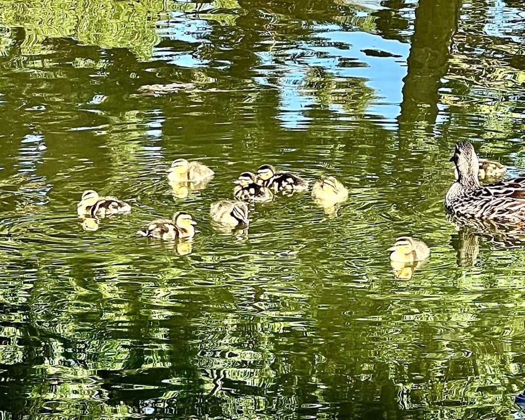
This may be the case with this brood or possibly the mother duck decided to raise a second family. That can frequently happen with ducks that don’t migrate since they don’t have to expend resources on migration; ours here stay through the winter.
Happy Saturday.
Tis the season …
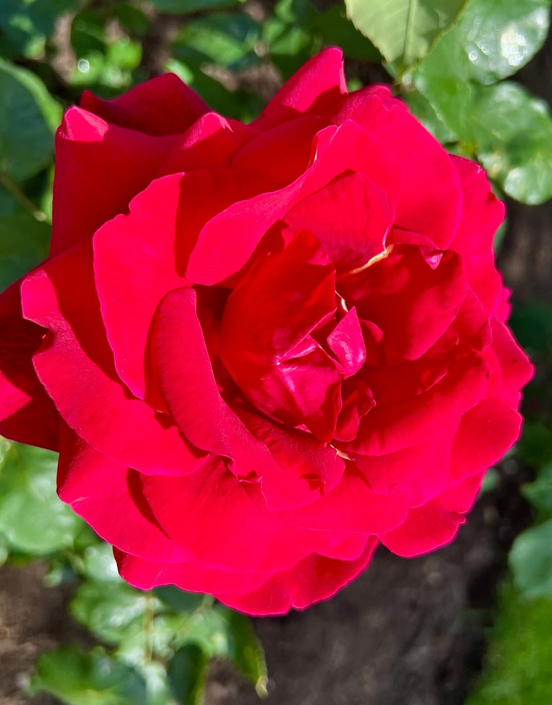
… for roses!

Alpine roses …

… yellow roses …

… variegated roses …

… it’s a rosy time of year!
Happy Friday.
I love fireworks and the city put on a good show out over the lake for Canada Day. The weather was perfect and there were lots of boats …
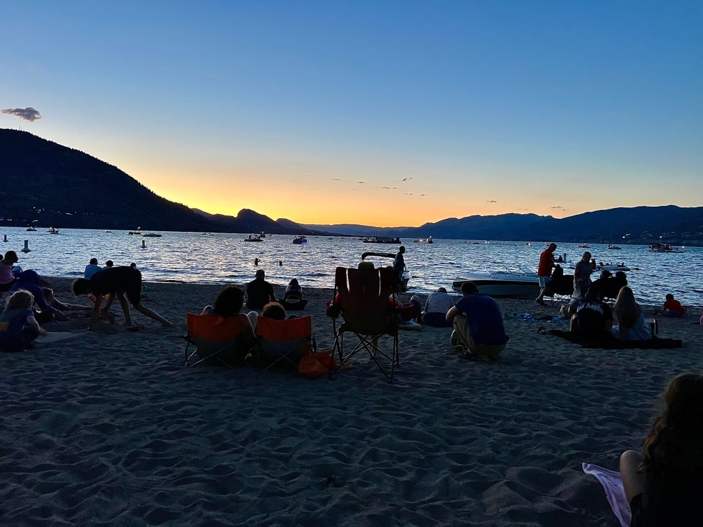
… and people on the beach …

… to see this …

… and this …

… and this, too …

…followed by a fantastic grand finale.
Happy Thursday. 🎇
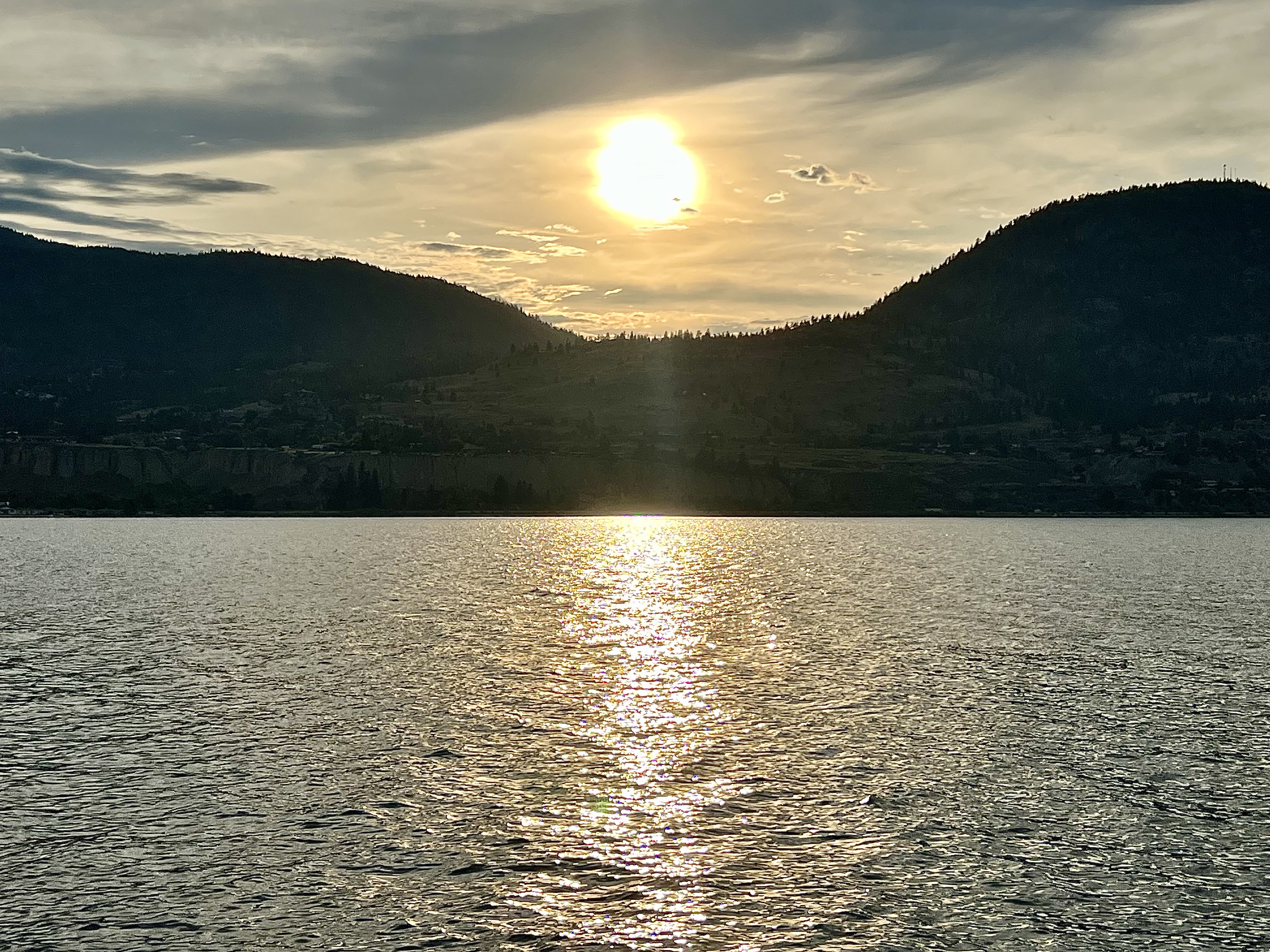
The lake settles into a glowing quietude …

… the intense heat of the day dissipating into the night …

… leading us to enjoy a calming reflection at day’s end.
Happy Wednesday.
Today is overcast with light showers, some of which never reach the ground but clouds are putting on a fine
Under A Strange Sky…
Gorgeous skyscape photos from John at Las Vegas Photoblog. Please click the link above to see more of John’s pictures.
… and it’s been an interesting year. Our sovereignty is constantly being challenged by Mad King Donnie …
… who is punishing us with tariffs and anything else he can dream up to try to force us to capitulate to him, while also lying, exaggerating and manipulating any and all information to communicate that we’re basically a hulking Godzilla of a nation just waiting to pounce on an unsuspecting and innocent little U.S.

So while the king to the south of us continues to consolidate his power by stomping on civil rights, threatening and taking revenge on opponents, universities, courts and newspapers and rewarding his wealthy oligarch friends while seemingly bent on devolving his country into a chunk of geography without law, order or structure apart from whatever reflects his own weird image, we’re becoming more and more angry.

Once our federal election was over at the end of April, things had sort of cooled off for a bit. Trump came along to Canada for the G7 meeting with the other leaders last month and although he had to talk incessantly and inanely before the cameras, things seemed to go well enough.
Then our Prime Minister went to the NATO meeting in Europe, was interviewed by CNN’s Christiane Amanpour, had the effrontery to state that he thought Trump’s annexation talk might be over, and boom, there it was again. No one’s going to tell Mad King Donnie what he thinks, including him.
So, this Canada Day, we should focus on what we know is good about us. And I’m not talking about crap like beavers, poutine, hockey, maple syrup, snow, fleurs-de-lys, and excessive politeness. Those are stereotypes.

Nope, I’m talking about those things that make us who we are: an understanding of the world that allows us to comprehend ourselves and our place within in it, directly and without artifice. An ability to hear people as they are, even if they’re talking complete nonsense through their butts – and yes, sometimes those butts belong to our own people.

A capacity to face our insecurities – and we definitely have them – by realistically confronting them and dealing with them, sometimes through self-deprecation and sometimes through sincere humility, even if we haven’t solved them. An awareness of how important it is not to take ourselves too seriously combined with an attitude of live and let live and helping out when we can. I think most of us love that about us. We’ll tolerate a lot … right up to where whatever it is starts stepping on our toes, and then we get pissed.
We are not the best, the biggest, the brightest, the toughest, the strongest or really, any other est. For that matter, neither is any other country, including our neighbour to the south. We’re all just varying degrees of whatever we are. But for the most part we Canadians have a good grip on what it means to just live a decent life, to give or share what we have when it’s needed, to try to understand the new and to accept it even if we don’t.

Are we perfect? Absolutely not. For starters, we can be lazy. We can be fractious, discontented and prone to squabbling and finger-pointing. And in the past, we treated our First Nations as completely and utterly worthless. We can be messy and sometimes chaotic but we always seem to find a path that works for us.

And that brings me right back to Donald Trump. In the struggle to preserve identity, people become seasoned, scarred, damaged, and in the process, changed and toughened. And that’s happening to us now.
While we try to ignore his name-calling, his bullying, his desire to stick a knife in us and twist it, and his pronouncements about how weak we are – or how difficult we are – depending on what lies he’s telling, we will not roll over into becoming the 51 state or more likely, a rights-less territory. And if he keeps pushing, there will come a time when what we’re learning will come into play.

So this Canada Day, it’s not about beavers and maple syrup or various actors, singers and sports figures who wear Order of Canada pins but haven’t lived in this country for years. It never was. At some point or other, we all face a personal Rubicon. As a nation, here’s ours. And we’re here, we’re us, we see ourselves, we know ourselves, and we don’t need to be – or want to be – anything else. 🇨🇦


