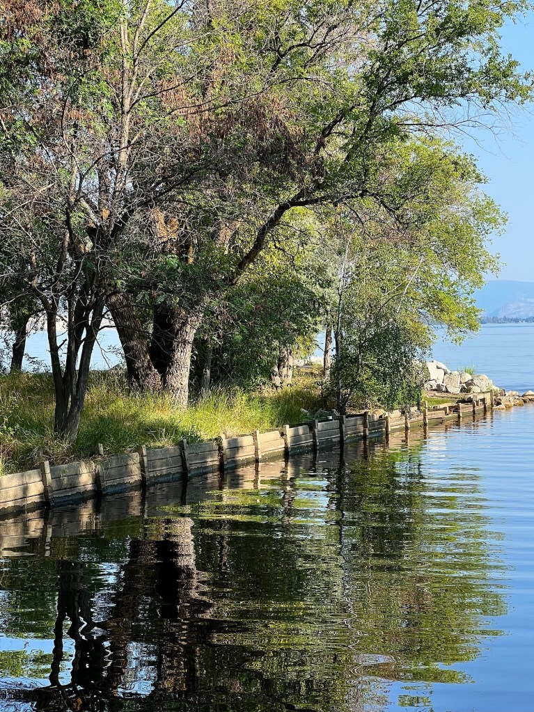
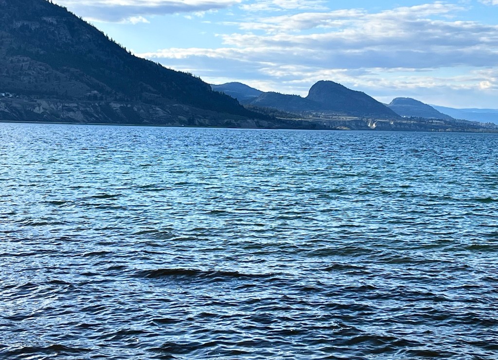
We had a heavy rainfall overnight – something that’s welcomed since we still have drought conditions – and the next morning the weather had left a beautiful flat calm as well as clearing views of Skaha Lake.
I love the gentle ripples that entirely covered the lake’s surface.
We seem to be getting the last of the greatest summer heat; today it was 31C (87.8F) and the temperature is expected to gradually drop into the high 20s over the course of the next week.
From an early morning walk.
The foliage, the water and the very air seem to be dropping back, sliding into a softness and a relaxation after the extremes of heat we have experienced.
Or maybe it’s not that elegant; maybe it’s just simple fatigue. In any event, I’m going to savour some beach afternoons in the cooler temperatures that are beginning to arrive. It’s time to enjoy the lakes that have been warming up all summer!
We spent a few days enjoying the benefits of the Icelandic hot springs and could easily see visiting one of them regularly if we lived here. The waters are extremely soothing, especially if you have any skin conditions, and the effects of the warm water very relaxing.
Mývatn Lake with an old magma field in the foreground.
However, as we enjoyed the Mývatn Lake hot springs near Reykjahlið in the north, we began to realise that bad weather was on the way.
After spending a comfortable night at a hotel in Reykjahlið, the next morning an employee warned us of an impending storm that was expected to arrive in the north during the course of the day, bringing freezing rain, ice pellets, gale force winds and possibly … snow.
Those white spots? Large, fluffy snowflakes!
We got going right away to our next stop, a hot springs spa in Húsavík, a town on the Greenland Sea, but the storm was beginning to settle in.
By the time we arrived for our appointment, the management of Geosea was considering closing because of the high winds, but decided to stay open when a lull occurred. Because we were within easy reach of our stop for the night in Akureyri, we stayed for our appointment.
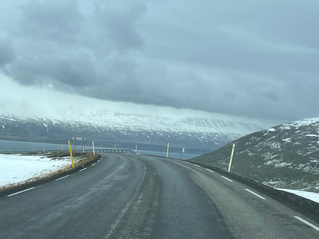
This is what we saw when we arrived in Húsavik: an overcast and stormy view of the Greenland Sea with snow capped mountains across the fjord.
The break in the storm meant that after our hot springs appointment, our short drive to Akureyri was fairly uneventful and lead us to believe that the storm might be abating, but we were in for a bit of a surprise.
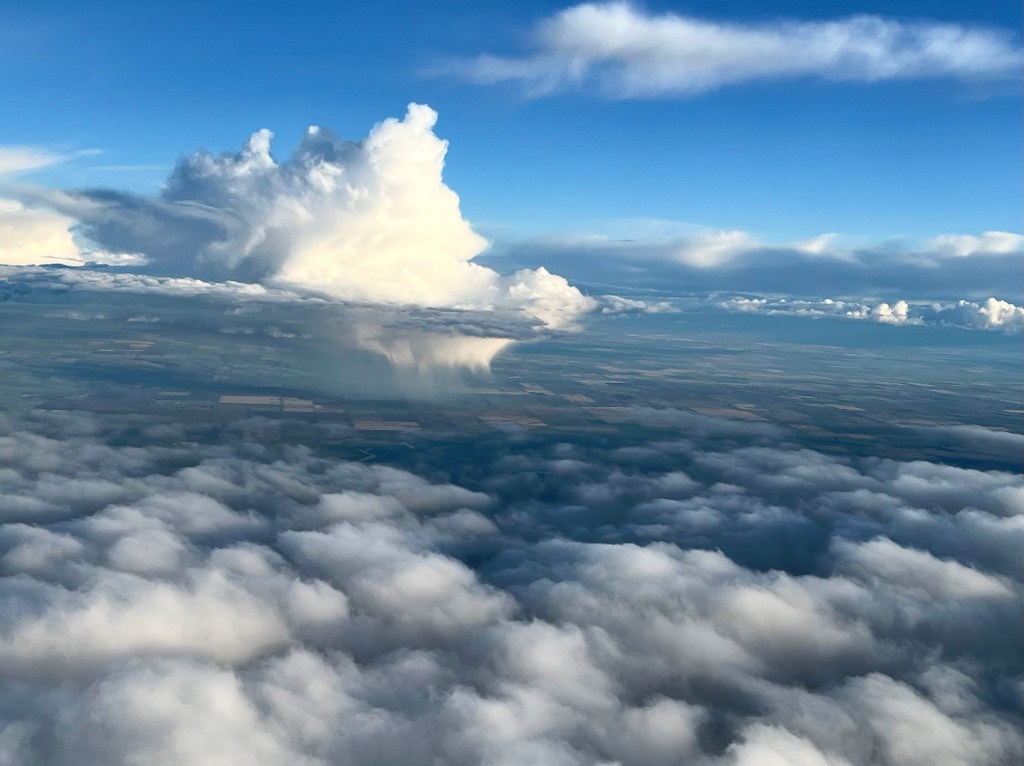
I have always loved the beauty of prairie cloud formations. Although they can grow into very damaging storms, most of the time they drop their wind and rain load and then dissipate.
The triangular cloud on the left is what is known as a “cloud with vertical development.” These are the ones that can cause storms, especially thunderstorms.
Its lower half was dropping a lot of rain near the Calgary area.
Although this one was showing a lot of vertical development, it was also on its own, not interacting with other clouds.
Southern Alberta seems to have recently received a lot of rain – courtesy of these thunderheads – a good thing considering that there were lingering drought conditions from last year.
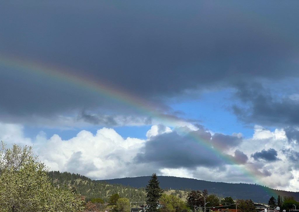
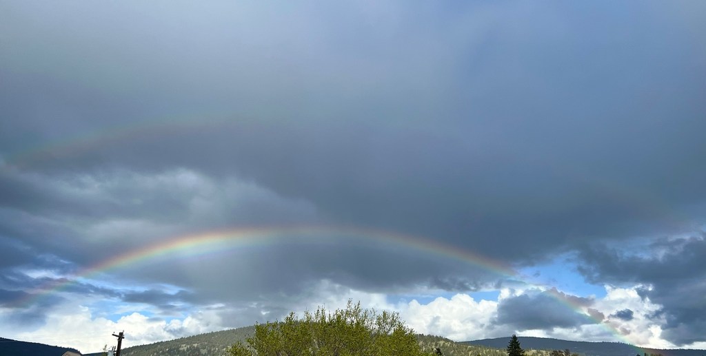
A few days ago I saw a particularly good rainbow. I didn’t have my camera but these cell phone pictures work okay, I think.
We have been having quite a lot of “sun showers,” where there’s a mix of rain-laden clouds together with sunny breaks.
The rainbow was in a perfect arc from north to south.
Rainbows are caused by refraction, the same process that produces sundogs. It occurs when light from the sun changes direction while passing through a medium denser than air, such as a raindrop. Refraction can produce some very beautiful sights.
The picture above shows that there was also a faint, secondary rainbow above the more defined one.
In common with the rest of western Canada, we’ve suddenly turned colder. We’re still above 0C (32F) during the day but are going below 0 at night. Meanwhile, Vancouver, very unusually, is apparently going to get wet snow and minus temperatures overnight as well. Ugh.
Of course, here in the Okanagan Valley we have it comparatively easy. Much of the prairies are getting highs around -20C (-4 F). Strangely though, a lot of the east is coming in at +20C (68F) but may be getting much colder toward the end of the week. Nevertheless, if you’re about to travel from east to west, a 40 degree temperature difference might make for a bit of a packing challenge – such wild weather!
So to take our minds off these bizarre differences, I thought we could do with some brighter pictures of what is to come.
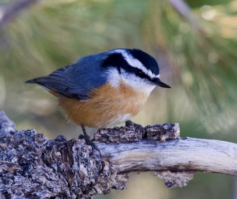
Nuthatch cuteness. Eagle magnificence. A butterfly tea rose. A sunflower with friend. Southern sunset beauty.
Happy March! It’s definitely the month for weather variability if not unpredictability. Cold wind one minute, warm sun the next. Depending on where you live, there might even be snow, sun, sleet, and thunderstorms all during the same day! It can at times be absolutely *spinny.
Although our weather has been somewhat unpredictable over the last couple of months – something that seems to be true in many locations – I hope it begins to settle into a nice slow spring.
Slow would be very, very good as we can probably then avoid a similar forest fire season as last year’s, something that is desperately needed given that much of the province is still classified as suffering from severe drought.
Happy weekend.
* spinny – Canadian word meaning foolish, silly or unreasonable
A major snowstorm struck to the north of us but since we were on the periphery of it we were the recipients of a lesser amount of the white stuff. Until it turned to rain later in the day, it was beginning to collect.
By late afternoon the snow at our lower elevation in the valley was gone, having been replaced by rain …
… and the weather cleared enough to give us a glimpse of a clear sky and sun.