Almost two weeks ago I published a piece indicating my concerns about the marmot colony in one of our nearby parks. You can take a look at it here. The gist is that I became quite unsettled about the degree to which the marmots were being fed, to the point that I was approached by one of them who begged for food.
That was very unusual behaviour. Up until a few weeks ago, the marmots had always scurried away when humans had come too close, but suddenly, people had started giving them a lot of food: bags of carrots, cucumbers, lettuce and other treats including nuts and berries.
Granted, these were healthy foods for the marmots, but the amount of it was causing ancillary problems: they were gaining weight, were losing their ability to forage for themselves and worst of all, were losing their fear of humans.
People were hand feeding them and the marmots were sitting on their laps, running over their shoulders and necks and the small ones were even climbing into their pockets. Now, marmots are very cute but they’re also wild animals; they carry ticks, fleas and sometimes, rabies.
Most people I know wouldn’t want to deal with the possibility of rocky mountain spotted fever, lime disease, bubonic plague, tapeworms or rabies, but marmots can potentially transmit all of these – or the pests – fleas and ticks – that also carry these diseases and live on the marmots.
Nope, humans being illogical humans, we believe that if it’s cute, it’s harmless. Or that it’s okay to feed wild animals because, well, we’re doing them a favour. Right?
So I decided that a visit to the city was warranted, and I learned that lots of other people have the same concerns as me, and that the city had decided that a warning sign was required.
And here it is (actually, there are two of them, one at each end of the marmot colony). Does it help to go to city hall? Yes, in this case it certainly did! I’m happy to report that these sweet little animals are back to feeding themselves, minimising our interaction with them and ensuring that they won’t be moved from their home or – worst of all – euthanised – because a child has been bitten or an adult has developed lime disease.
I wish the marmots long life and health and to us, many more years of marmot viewing pleasure – from a distance, that is.
I was (and still am) a big fan of Anthony Bourdain. I remember finding his first show, “A Cook’s Tour” on a minor travel channel and soon found myself completely hooked. I read all of his books and watched all of his shows as they came along.
Photo courtesy of Alex Welch, New York Times
I was raised in French-speaking Canada, learned to cook in the French country way, and I always felt, even from a very young age, that one of the best ways to understand a culture is to try its food. So when Anthony Bourdain came along, with his French name and food/travel attitude that aligned with mine, I thought yes, finally! Here’s someone who’s doing a thoughtful travelogue-and-food-as-cultural-identity show.
Icelandic salmon
My desire for travel was inspired by my childhood trips to my mother’s homeland, the UK. On one of these visits, she took me on a side-trip to Paris, and that’s where for me, food and travel merged and grew. Since then, and although I’ve now slowed down, I’ve travelled enormously and have always, first and foremost, accessed a region’s culture through its food.
The best seafood chowder ever; from a visit to Reykjavik.
Food is who we are. We depend on it not only for the practical purposes of sustenance, but also for comfort, warmth, remembrance, history and connection. Food brings us together, both in celebration and mourning, in romance and heartbreak, and very often, just as a pleasure in and of itself.
Many years ago, in a very small neighbourhood restaurant in an off-the-tourist path, outside-of-tourist season part of Venice (this was when actual Venetians still existed, before that marvellous city was more or less turned into a theme park), I was introduced to a wonderful rendition of linguine alle Vongole (linguine with clams). I wound up spending much of the afternoon chatting with the owner, he in his broken English and I in my very poor Italian, drinking local wine and learning more about Italian food – and Italians – than a dozen cook books could ever provide.
Mushroom pasta, one of my favourites.
And this is one of the best things that Anthony Bourdain shared with us: the idea that food is travel, and travel is food. It’s about connecting with the people who make the food, about why it’s an important part of their culture and by extension, why it is that we want those particular foods to become a part of ours. It’s mind opening.
A traditional favourite in my family: winter tourtière (meat pie).
It’s very sad that despite Bourdain’s reverence for travel, for food, for life, his was cut short by one of the very things he frequently discussed in his programs: the human condition. Our condition can be a complex, circuitous mystery, quite often particularly to ourselves. He was so ably conversant with it and at times showed such insight, but as it is for many of us, he clearly had a hard time dealing with his own condition.
A wonderful seafood pasta.
Regardless of the manner of his passing, he gifted us with an enormous body of work. Often irreverent and acerbic, sometimes scandalous but always passionate and honest, Anthony Bourdain communicated his observations and philosophy through the wonderful medium of food, a medium we can all understand, and I will always appreciate him for that.
After his passing, friends of his, Eric Ripert and José Andrés, started an unofficial Anthony Bourdain Day on June 25, his birthday (yes, I’m a day late). So if you’re inclined to honour him, his favourite drink was a negroni, and one of his favourite foods was pasta, and you can eat and drink in his memory.
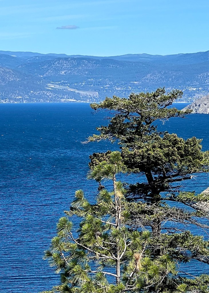
Our weather lately has been a mix of sun, rain and wind; short, intense rain storms have been quickly followed by sun and then more rain. This has left Okanagan Lake looking both settled and uneasy.
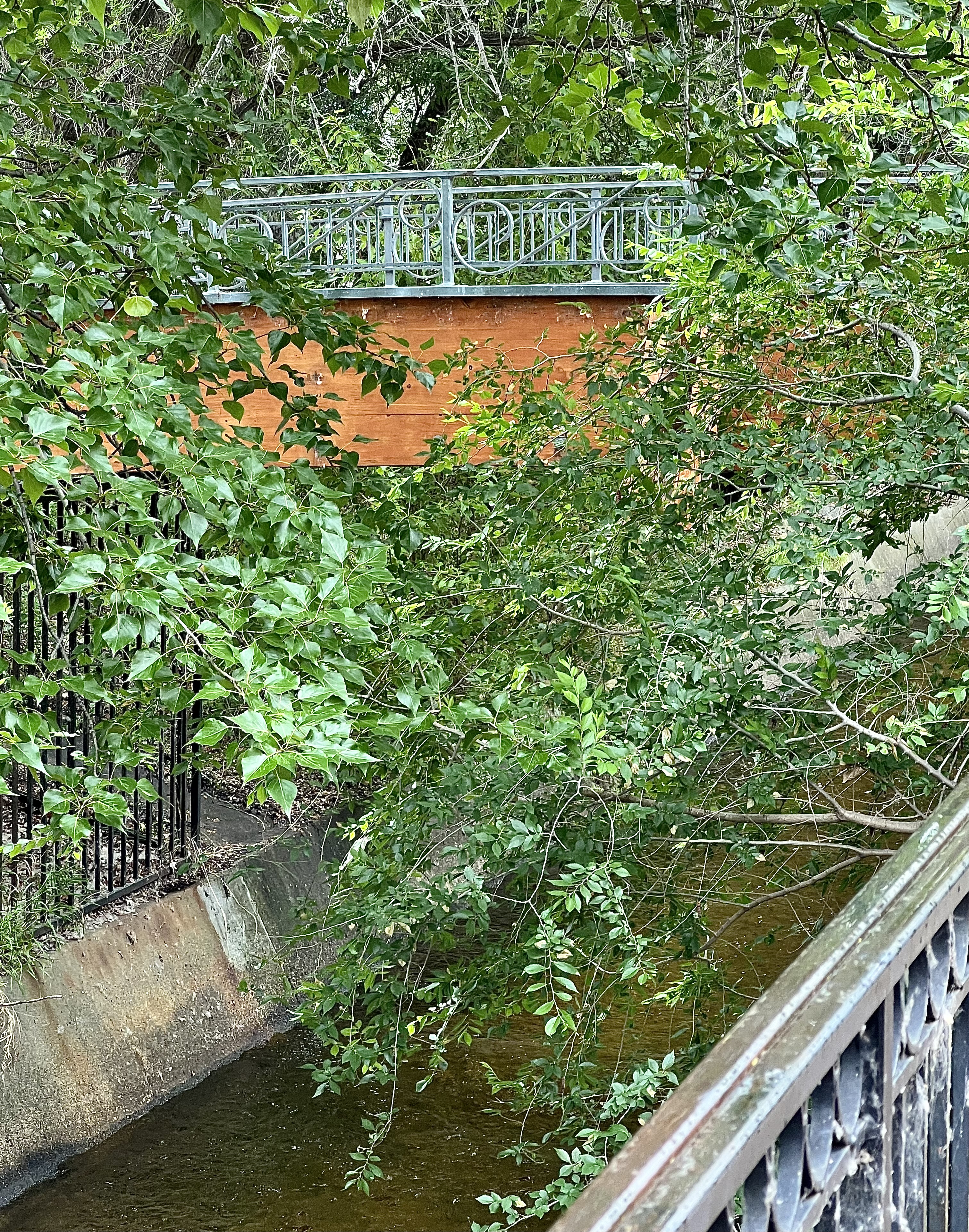
Yesterday I posted about the bridge over Penticton creek but today I’m moving about 400 metres (1300 ft) further along to where the creek empties into Okanagan Lake.
By this time of year, this creek is usually moving very slowly, desultorily, somnolently with only a little water trickling through the centre of this channel.
This year, however, it’s a regular river with lots of water and very happy trees and ducks. After years of drought, this verdant growth is wonderful to see!
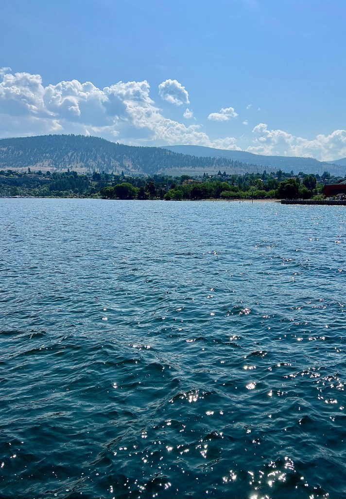
And here it joins the lake, adding to the lake’s water level and giving everyone on the bridge another lovely view.
We live near Penticton Creek and one of its pretty foot bridges.
Usually, this creek is now down to a little dribble, but because we had a wet autumn followed by a wet winter and then a wet spring, this creek has been very full and running swiftly.
And all that very welcome rain – we had been experiencing a three-year drought – has turned the little creek into something of a river, especially where it widens out to empty into Okanagan Lake.
I often stop to admire it, to listen to its gurgling and to enjoy all the trees growing near it …
… trees that are very verdant this year because they have had lots of water …
… and to also enjoy the flowers that occasionally grow there, too.