
We had a lovely day hike through the Maligne Lake and River section of Jasper National Park.

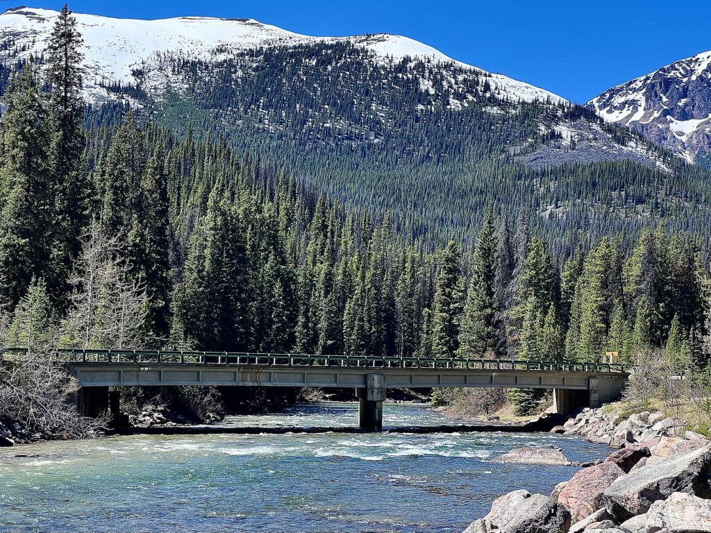

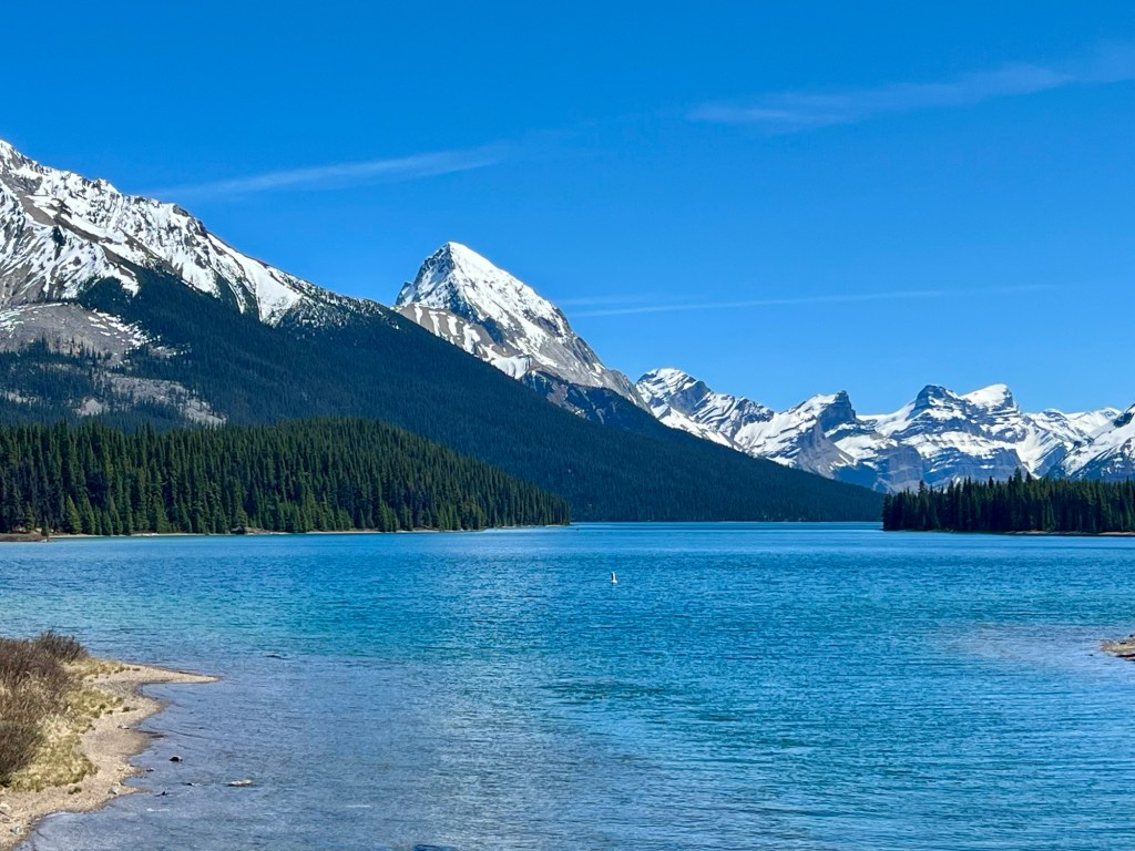
The warm weather, bright sun and fresh air was wonderful.
Happy Tuesday.
We had a lovely day hike through the Maligne Lake and River section of Jasper National Park.
The warm weather, bright sun and fresh air was wonderful.
Happy Tuesday.
On July 21, 2024, four wildfires started within the boundaries of Jasper National Park. At the time, the park had been experiencing serious drought conditions that were accompanied by hot, dry winds. Three of the fires were caused by dry lightening strikes and the fourth through human ignition: sparks from work on a car engine started a grass fire that quickly escalated.

The next day, July 22, all four fires merged into the largest one ever recorded in the park for the previous 100 years; it eventually developed a self-perpetuating weather system containing fire tornadoes and continuous high winds.

By July 25, 25,000 people had been evacuated from Jasper townsite and the park itself. By July 26, Parks Canada announced that 358 of the 1,113 structures within Jasper townsite were damaged or destroyed but that all critical infrastructure such as the hospital, schools, and the wastewater treatment plant were saved.

It took until August 17 for the fire to be classified as “held” and on September 7, it was declared as “contained.” One fatality occurred; a firefighter died when a burning tree fell on him.

It’s completely normal for forests to periodically experience burns. Decades-long collections of dry forest floor detritus together with occasional hot summers have always caused them.
It’s also normal for our planet to experience periodic warming and cooling trends. However, the normal heating trend that we’re currently experiencing has been exacerbated by human activity which has lead to higher temperatures and drier conditions than we should have; this in turn brings about more and larger fires. These fires lead to more planetary heat, and the cycle continues to grow.

Nature is amazingly resilient, however. It has been less than a year and already the grasses and bushes are returning; the ungulates love eating the new growth and they have the added advantage of being able to better see the predators! The trails – even through burned areas – are re-opening and visitors are returning, too.

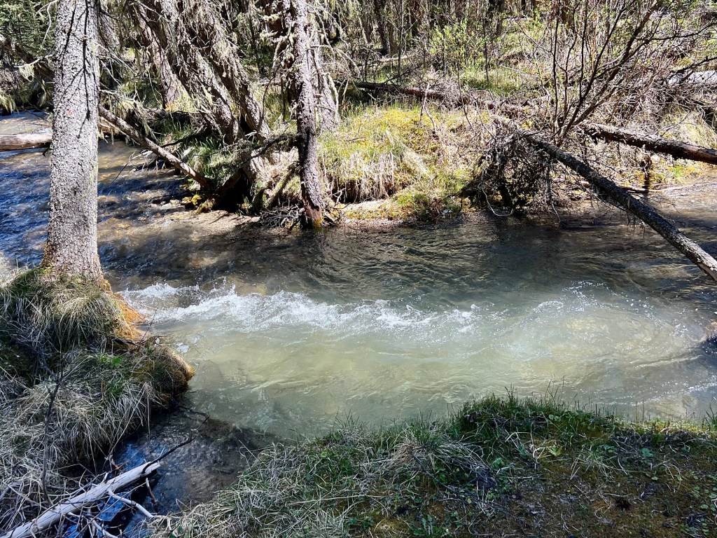
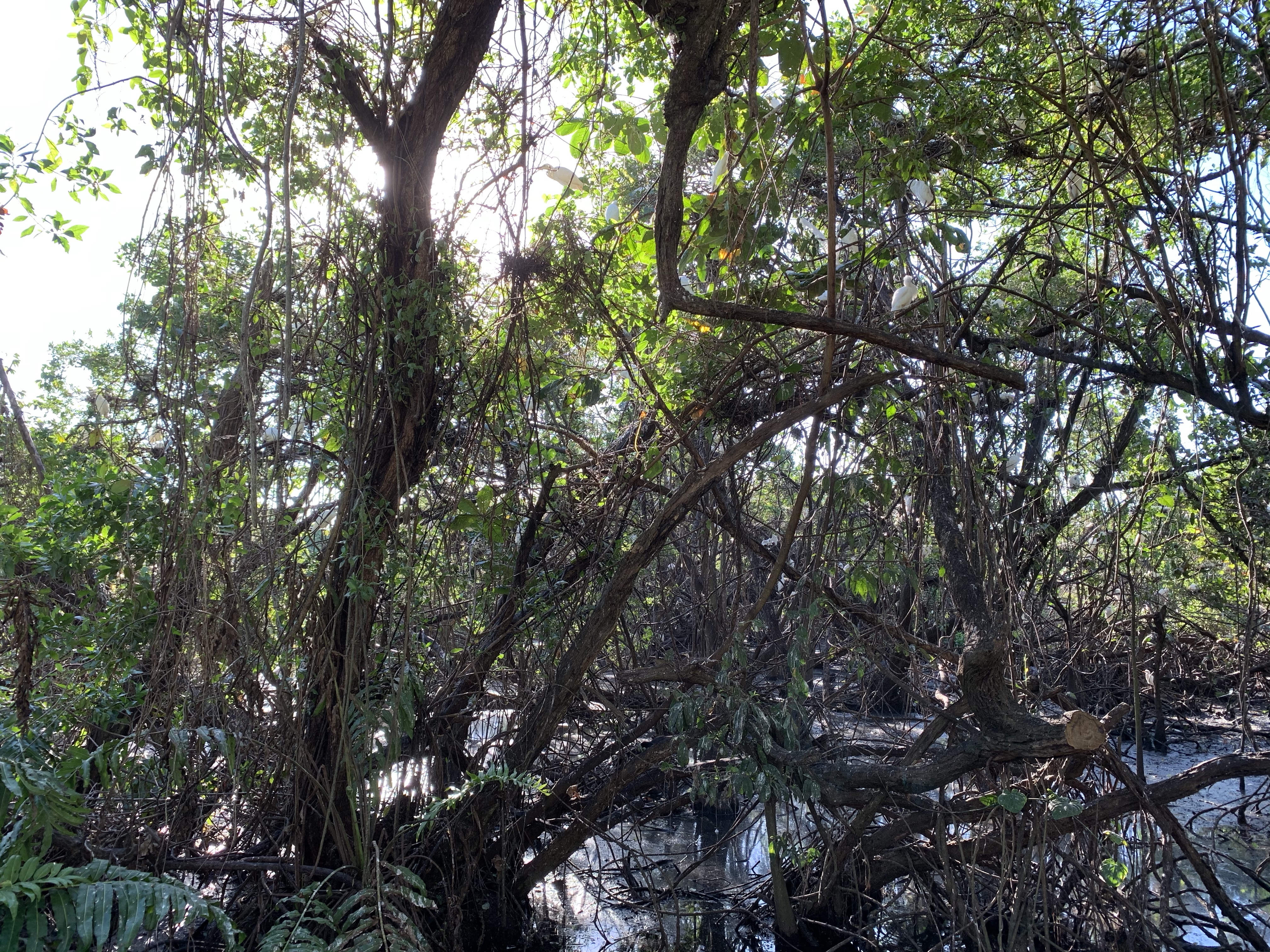
Much of this gorgeous gem of a park escaped the fire …
… and after a morning of clear-sky hiking through stunning scenery we sat next to this lovely river to eat lunch. This particular restaurant had a great view!

Jasper’s fire is a reminder that nature does things in ways that she selects as healthy responses to certain conditions; sometimes, those responses are swift, brutal and merciless. But human interference in that process will eventually lead to consequences, consequences that are worse than what we’re now seeing with the cataclysmic sweep of fires now burning through three of our western provinces.

Let’s hope that we learn nature’s lessons before she decides that we’re the problem and we’re selected for discontinuation.
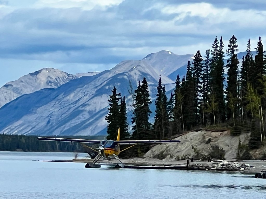
During our recent trip through northern British Columbia, Yukon and on to Jasper National Park we saw lots of animals, but they visually weren’t at their best. They have just come through winter, they’re in the process of shedding their coats, and they either have young ones or are about to. In short, they are busy parents just trying to recover from winter cold!


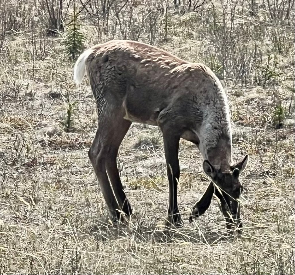


Being able to see all these animals was particularly wonderful especially as most of our sightings were in a national park where they are well protected.
Happy Sunday.
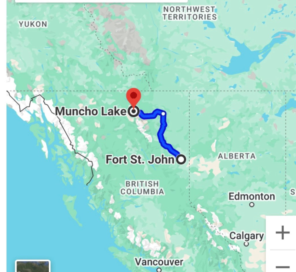
The next leg of our trip took us from Muncho Lake to Fort St. John, a six-and-a-half hour journey that we broke up by stopping to take walks and also to admire the magnificent scenery along this route (highway 97 or also called the Alcan or Alaska Highway).
Because there are so many beautiful natural sights, you will need to stop often to really do them justice …
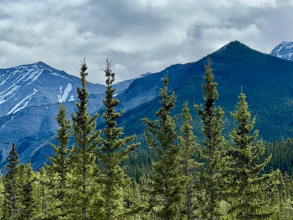
… but I have learned over the years how to take pictures from a moving vehicle, too (not while driving, though!).

That said, stopping is best, both to stretch your legs as well as to see all these stunning natural wonders.


The next day found us arriving at one of Canada’s gems, Jasper National Park, so there are more posts coming about that beautiful part of the world. That said, any visit to Jasper also includes a look at the terrible destruction caused by the forest fires that started there in late July, 2024.
After we enjoyed the hot springs at Liard River, we stopped at Muncho Lake Lodge for the night. We had a great dinner and more fantastic views.
Amazingly crystal clear, Muncho Lake is a feast for the eyes. Can you tell if this photo is upside down or not?

Actually, it’s right side up; you can see some irregularities in the reflection if you look carefully. Nevertheless, that’s a fantastic mirror image of some of the Northern Rocky Mountains, isn’t it?

Muncho Lake, like many of the Rockies’ lakes, is green. Caused by glacial sediment, some lakes can also be various shades of cobalt blue interspersed with green. That green shade isn’t evident in the first picture because of the light’s angle refracting from the lake’s surface.

The next day we stopped in Fort St. John, after having travelled much of the stunningly beautiful highway 97 (Alcan or Alaska Highway), so there is another post coming about the fantastic sights we were able to experience during that fantastic drive.
The Liard River is one of the more major rivers in northern British Columbia.

As we left Yukon and began to drive south on highway 97 (also known as the Alcan Highway or Alaska Highway), we paralleled it for some time before it made its way east.

Before that, however, we stopped at the Liard River hot springs for a dip. I was glad that we didn’t have far to go afterward because following that appealing break we were very, very relaxed!


Rugged and swift, the Liard River is a part of highway 97’s extremely scenic landscape and with the added bonus of lovely natural hot springs, our first day’s drive on this route was wonderful.

There’s more to come from this spectacularly gorgeous drive. I thought that the Stewart-Cassiar highway was at the top of the heap for beautiful drives, but highway 97 is right there, too!
Watson Lake, Yukon, is famous for its signpost forest. Signpost forest, you ask? Yes, this community has a forest composed entirely of signs, all kinds of them.
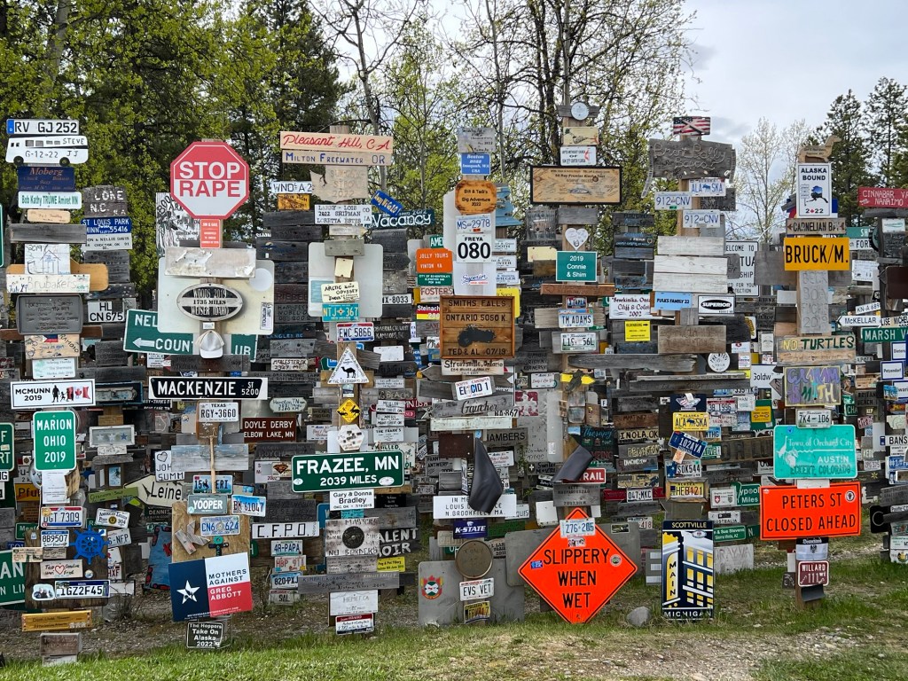
It all began in 1942 during the construction of the Alcan (Alaska) highway when the engineers working on the highway erected signs listing places, directions and distances to locations in Yukon, to other Canadian locations and to U.S. locations as well.

Carl Lindley, a homesick WW II soldier, added his hometown sign to the army signpost and started a tradition.
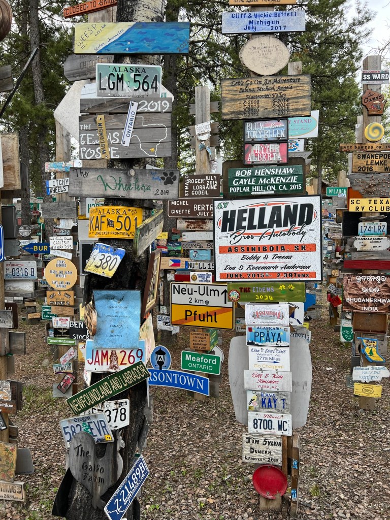
Since then, people from all over the world have added hometown signs to the forest. At last count, there were about 60,000 signs that include vehicle licence plates, homemade placards and other glyphs, symbols and signifiers.
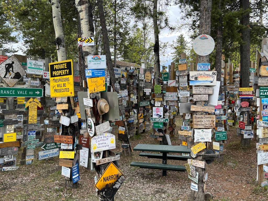
In 1992 when Carl Lindley returned to Watson Lake with his wife, Eleanor, for the first time since 1943, he was overwhelmed at how the signpost forest had grown.

During a sign reenactment ceremony, he replaced his original sign – the first one had since rotted away.

The signpost forest is one of the best-known attractions along the 2414 km highway from Dawson Creek, B.C. to Fairbanks, AK.

The sign pictured above gives the history of the forest including a picture of the original signpost.

Happy Tuesday.
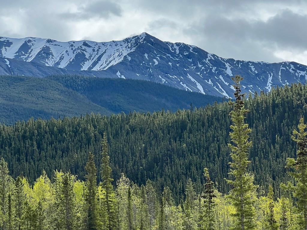
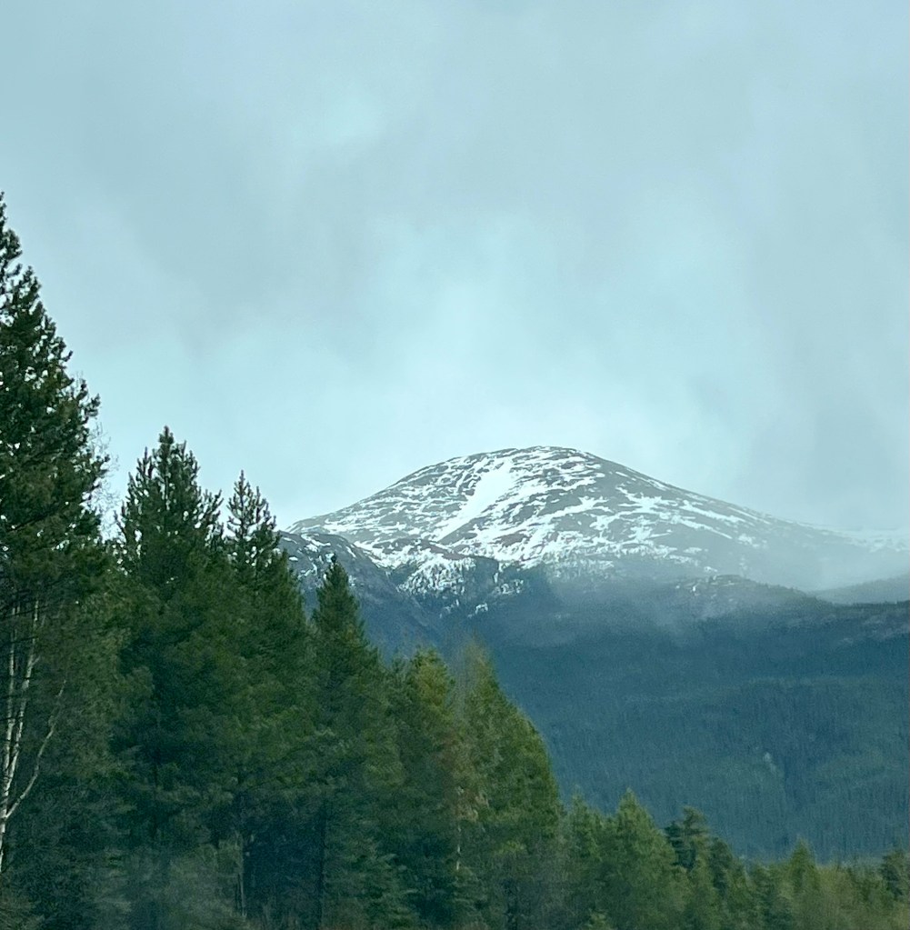
During our trip through northern British Columbia and into Yukon we have seen some beautiful mountains and mountain ranges.

This is part of the Coast/Central Mountain range that bisects British Columbia. We paralleled or drove around much of this range while en route to Yukon on the Stewart-Cassiar Highway. I love the pea green, new deciduous growth that we saw everywhere. Spring is definitely later in the north.
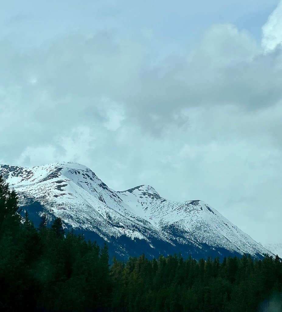
We experienced quite a few showers interspersed with sunny periods, but saw that a lot of snow was still falling at the higher elevations.
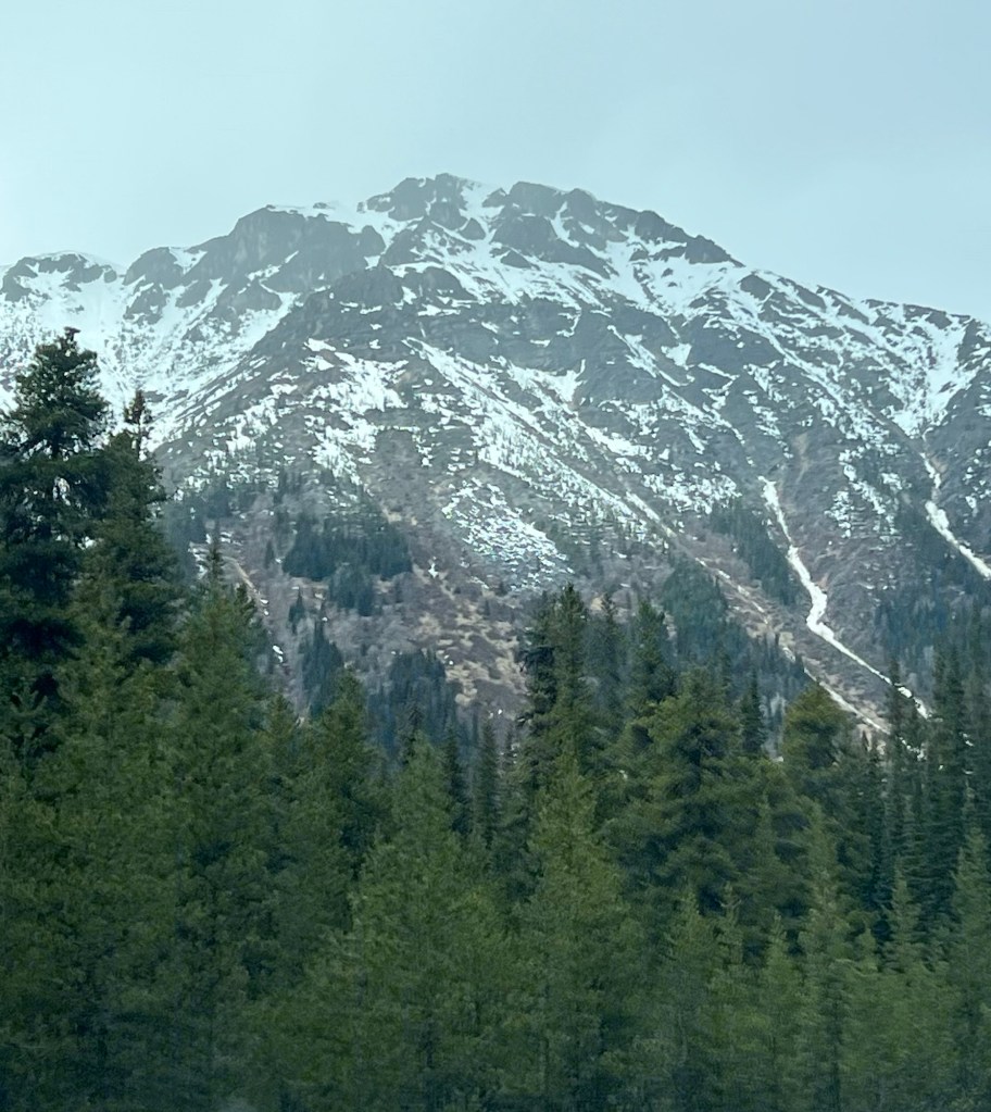
Neither M nor I had ever driven this route – the Stewart-Cassiar Highway (highway 37) – before and found it spectacularly beautiful. The Coast/Central Mountains aren’t as tall or rugged as the Rocky Mountains but still breathtaking. It’s well worth the drive and if you’re inclined, there are lots of opportunities for camping, hiking and fishing.

Highway 37 goes north from the junction with highway 16 just west of Prince George and Hazelton and is a total of 725 km (450 miles).

Below shows the highway’s terminus at the Yukon boundary.

This highway is very remote and there’s no cell service (except emergency), but we found that quite attractive. If you’re interested in this trip, here’s a website that might be helpful.
Happy Monday.
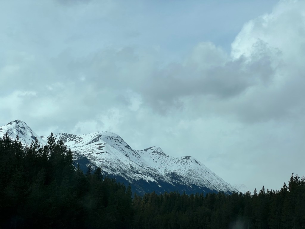
We have finished the 855 km (531 miles) Smithers, B.C. to Watson Lake, Yukon, leg of our trip via the Cassiar Highway (highway 37).
We experienced quite a number of rain showers broken by sunny periods but that didn’t dampen the beauty of this route. It’s one of the most stunning that you will find anywhere. We at first paralleled the Central Mountains but after turning a few more degrees due north, we drove through them for about 600 km. (373 miles).

We didn’t stop to do much hiking or walking through this portion of our trip but there are many opportunities for that and of course, there are lots of places to camp or to stay at a lodge.
As long as you are aware of and cautious about bears, there are many, many outdoor activities to be enjoyed in this area of the country.
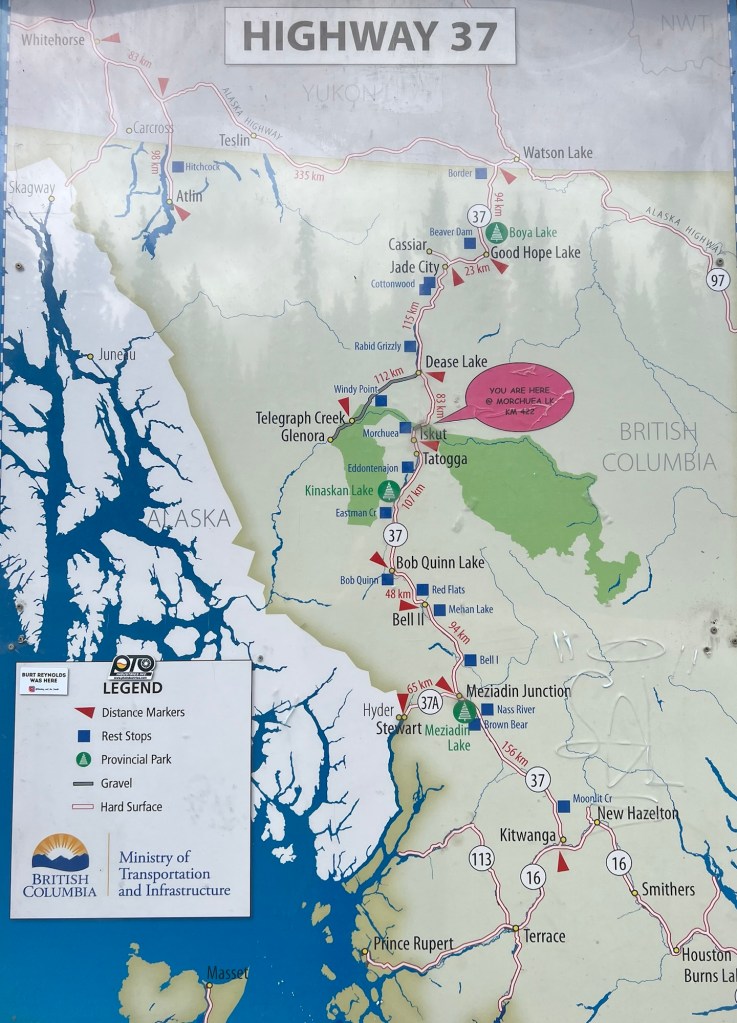
Here’s a rest area sign showing details of the Cassiar.
Happy Saturday.
I like taking pictures of roads.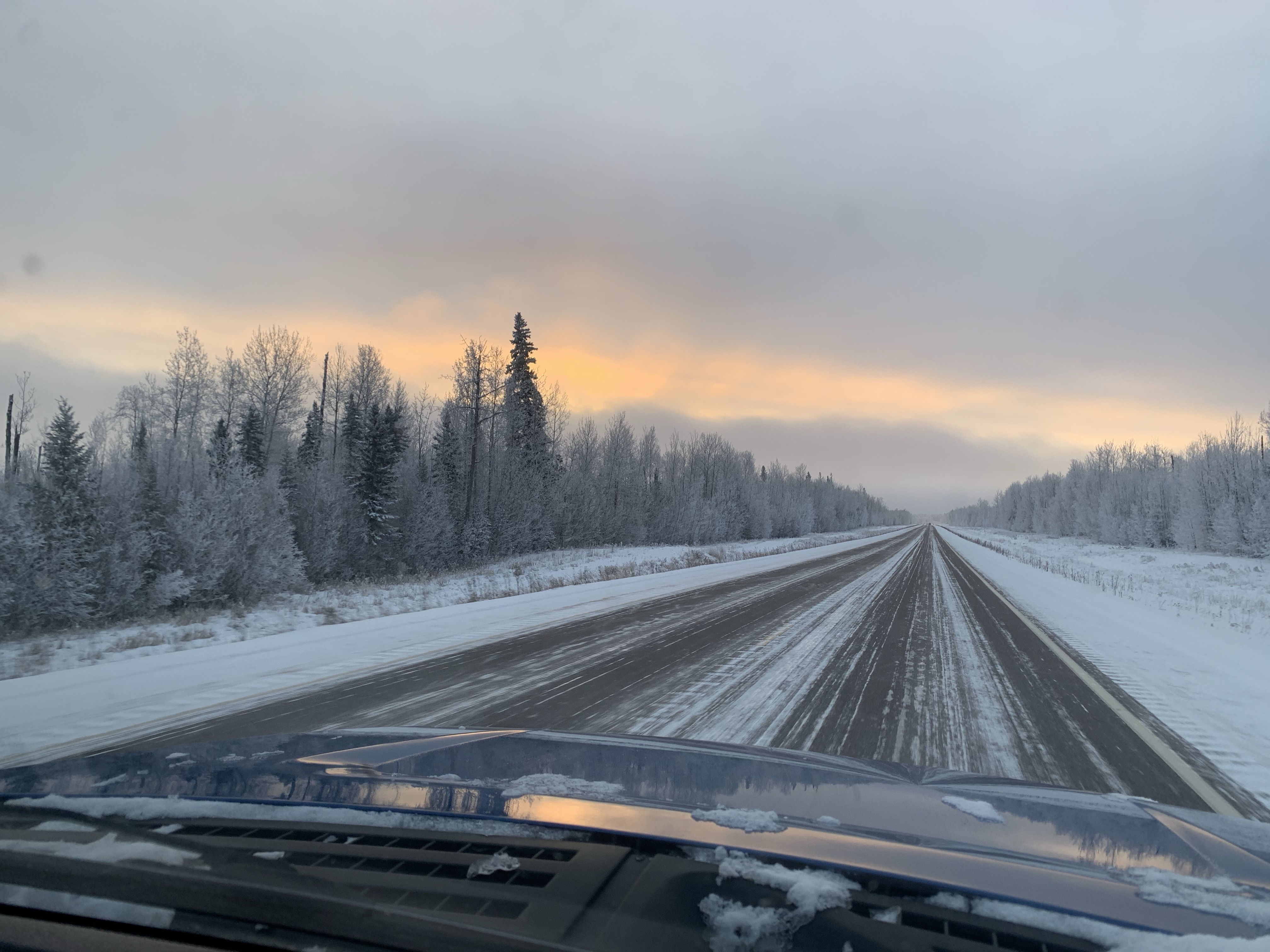
I think that’s because the journey has always appealed to me. I have been on many.

But unlike these roads, my journeys have never been straight.

They have looked more like this.
You?


