Beautiful photos of one of our Rocky Mountain treasures, Emerald Lake, courtesy of Allan at Picture This. Please click the link above to see the entire set. Thanks for sharing your pictures of this gorgeous spot with us, Allan.
A beautiful photo from James Elkington at Mountains, Myths and Moorlands. James has many beautiful pictures on his site; please click the link above to see more of them.
It recently occurred to me that this blog has been running since October, 2012 – quite a long time. Although it’s not my blogversary, I feel like doing a photographic “looking back” series and posting some pictures that have been buried for a while. These are not necessarily great photos, they’re just photos that I like, that evoke strong feelings.
Orchards …
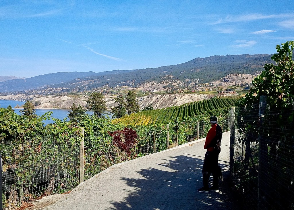
These pictures are from an early autumn holiday visit to the Okanagan Valley in 2012. We knew we loved it, but didn’t know then that we would eventually move here.
… a distant boat …… and M and I hiking among the grape vines.
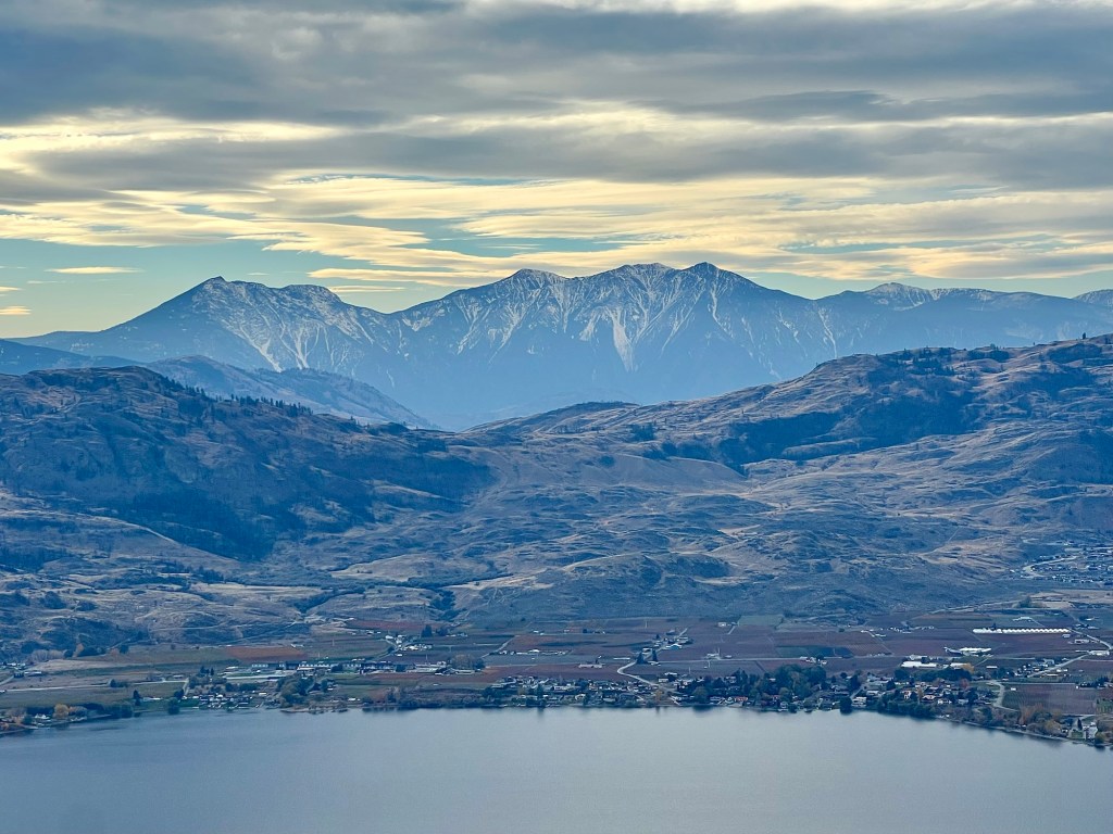
Osoyoos is a community at the southern end of the Okanagan Valley, British Columbia, and is directly next to the border with the United States. It’s only 60 km (37 miles) south of us from Penticton. We recently visited and took some photos of it from Anarchist Mountain, which at 1491 metres (4892 ft) above sea level provides some excellent views.
A southwestern view of Osoyoos Lake with the United States in the distance.A western view of the lake with the Monashee Mountain range in the background. And another western view but a bit more northerly. Looking more toward the north.
Osoyoos is at the northernmost tip of the Sonoran Desert and can be extremely hot during the summer; it’s quite arid year-round. It’s known for its fruit orchards and the dry conditions also produce some stellar red wines. It’s a great place for outdoorsy summer holidays with lots of boating, swimming, camping and hiking and is definitely worth a visit if you like those activities – with maybe a nice glass of wine in the evenings!
The Bulkley River of northern British Columbia is a major tributary to the much larger Skeena River – I’ll post pictures of the Skeena later; it’s huge.
Bulkley River with the Hazelton Mountains in the background. Rapids on the Bulkley River.
This river is greenish-grey which indicates that it’s fed by glaciers and their forceful runoff. The colour comes from pulverised rock particles that absorb and scatter sunlight; the rivers and lakes near the Rockies are an impressive bluish-green.
We recently left Penticton, British Columbia en route to Haida Gwaii, an archipelago off the northern Pacific coast and the home and ancestral territory of the Haida First Nation. Getting there would take three driving days and one ferry.
Haida Gwaii
After stopping for the first night in Prince George, we continued on to Smithers.
Smithers
Smithers is near the Hazelton Mountains which are a sub-range of the larger Coast Mountains. In winter there’s a lot of good downhill and cross-country skiing and in summer the hiking is fabulous.
Hazelton Mountains
After a decent night’s sleep we drove to one of the peaks and found a good hiking trail.
As we neared the trail head the temperature went down to 24 C (75 F) from 33 C (91 F) in the town of Smithers below. It was a much appreciated break from the heat wave we’ve been experiencing all over British Columbia.
M scoping out the trail.
Being able to enjoy the trail in much cooler temperatures was a real plus.
From Smithers all the way to the coast, the forest is lush, dense and beautiful. This is because even though Smithers is fairly far north, its climate is mitigated by the temperate rainfall from the Pacific Ocean which leads to these lovely, almost-rainforests.
There were a number of powerful glacier-fed waterfalls on our route that we stopped to admire.
All too soon we needed to return to our vehicle to continue our drive to Prince Rupert and the coast. Our ferry booking for the sailing to Haida Gwaii was coming up next.
When we stopped for a little hike while on our way to Sault Ste Marie, we spotted the pretty little town of Spanish below the trail bluffs.
It’s protected a bit from Lake Superior because it’s on an inlet, a good thing since storms on this lake can be rather nasty.
It was still a bit early for the marina to be populated with boats but it wouldn’t be long.
We had a beautiful vantage point over the lake and the little town; the trail was quite a nice one if rather buggy. We had to really keep moving to stay ahead of them.