The Kettle Valley Rail Trail is a 660 km decommissioned passenger train line that used to run through southern British Columbia from Hope to Castlegar between 1910-1964.

It continued to be in operation as a freight line until 1989 and after it fell out of use, the tracks were removed and it was re-purposed as a hiking, running, walking and biking trail.

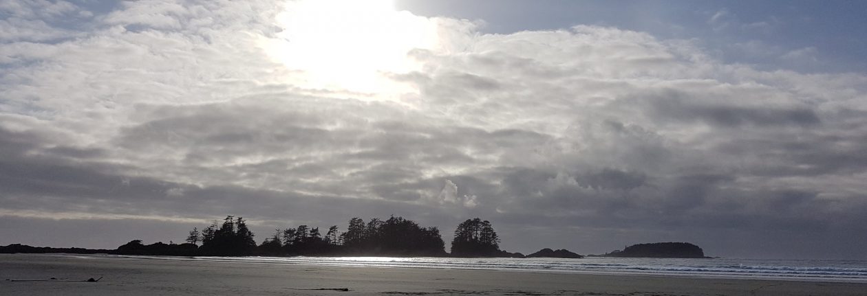
M and I have walked chunks of it in all seasons; it has terrific views with the Columbia Mountains to the east and the Okanagan Mountains to the west.

The KVR is also part of the Trans Canada Trail, a cross-country network of trails, waterways and roadways that stretches from the Atlantic to the Arctic and Pacific Oceans.

The Trans Canada Trail, at 24,000 km, is the longest multi-use trail system in the world.

We love having this trail almost at our doorstep and are so happy that 35 years ago, a group of forward-looking people decided to band together to re-purpose an old rail line.
Happy Tuesday.

I love it when these disused roads / tracks re reused. This looks like a good surface to walk on, and what incredible views!
LikeLiked by 1 person
I do as well. This trail is extremely popular with bikers and hikers. There is camping 30 km further up the trail from where the pictures were taken and the next city is another 30 km after that. The trail is beautifully maintained year round, so it’s wonderful to be so close to it. Cheers.
LikeLiked by 2 people
Excellent thing to have a path in such good condition and close to home where to enjoy walking and views!
LikeLiked by 2 people
We are really very fortunate. We wanted to have access to good outdoor activities and this trail is one of them. And yes, the views are fantastic – a great reward for climbing up the grade. 😊
LikeLike
What a beautiful place to go hiking and the path looks so great to walk on it.
LikeLiked by 1 person
The trail is very well maintained and it’s beautiful for hiking at any time of year. Cheers.
LikeLiked by 1 person
Twenty four thousand kilometres!?! That is some trail!
LikeLiked by 1 person
Yes, Canada is pretty big, especially to the north. When I was in the military and posted to Alert on Ellesmere Island in the far north, I was 4600 km from Toronto in the south; Canada is about half as tall as it is wide. Because of that and since the trail goes to the Arctic Ocean, there’s a lot of added distance. Cheers. 🙂
LikeLiked by 1 person
Good use of an old railway line and it takes you to nice views. Maggie
LikeLiked by 1 person
I agree, Maggie. It’s so fantastic that a group of people formed a society to fundraise for and organise the re-purposing of it after the tracks were removed. You can bike or hike the 70km between Penticton and Kelowna and there’s a mid-way camping/hotel option with restaurants and a lake. It’s pretty great.
LikeLike
Oh that would be a great bike trip! Thanks for the info.
LikeLiked by 1 person
It’s very popular. 🙂
LikeLike
A spectacular use of an old rail line Lynette. Always meant o explore here, but have not made it yet. Thanks for sharing. Happy Tuesday. Allan
LikeLiked by 1 person
Thank you very much, Allan. It really has been put to good use; this trail is very popular. So good to see that and how successful it is. I hope you’re able to visit some time as I think you and Patty would probably really enjoy it. Cheers.
LikeLiked by 1 person
That is wonderful. I walk the same circle through my neighborhood every time. I can’t do hills and it’s flat. Your trail looks pretty level.
LikeLiked by 1 person
It sure is, Jacqui. It’s an old railway bed that climbs into the mountains, but railways always have to have very gradual inclines. This one is only 2.2%, so it can be quite accessible. Cheers.
LikeLiked by 1 person
I’ve also walked portions of the Trans Canada Trail. What a wonderful way to connect the country. You’ve captured some beautiful vistas, Lynette!
LikeLiked by 1 person
Thank you very much, Belinda. 😊 Agreed – the Trans Canada Trail is a fantastic connector.
The views from this trail are really stunning. I’ve thought of the train passengers who took this route before WW I when it was apparently quite fancy and then they had the marvellous views as well. It was definitely a different time.
LikeLike
How lucky those passengers were!
LikeLiked by 1 person
Yes, they sure were.
LikeLiked by 1 person
How fortunate to have this trail so near and accessible. Looks like a peaceful and lovely place to stroll.
LikeLiked by 1 person
It is definitely wonderful and the views are marvellous. People can do as much or as little as they want; many will cycle or hike 35 km further on where there’s camping, hostels, a hotel, restaurant and lake.
LikeLiked by 1 person
I love rail trails – although I regret the loss of train service that used to be there! WP hid this post; I had to go through Reader to get to it. Sigh. But it worked –
LikeLiked by 1 person
Yes, train service, especially through the mountains, was pretty wonderful. But agreed, turning the old rail beds into trails is a great re-purposing.
I’ve been in contact with a WP tech person about why this post is hiding – my tags aren’t working, either. Thanks for letting me know that you had trouble seeing it. Cheers.
LikeLike
Gorgeous.
LikeLike
It sure is. 😊
LikeLiked by 1 person
How lovely!
LikeLiked by 1 person
It’s such a beautiful trail. 😊
LikeLiked by 1 person
Beautiful. Thanks for sharing.
LikeLike
You’re very welcome. 😊
LikeLike
What a great use for an old rail line! Looks like a lovely spot to hike and enjoy the views.
LikeLike
It’s really terrific as it’s wide and smooth and is well maintained. We have hiked a lot of it in chunks; there’s a 70 km stretch between here and Kelowna with camping, a hotel, a restaurant, hostel and lake at about the 35 km point. That’s perfect for an overnight biking trip although too much to hike in a single day. I’ve heard of people breaking it up into a 4 or 5 day hike and that would be great as the scenery along the way through the mountains is beautiful.
LikeLiked by 1 person