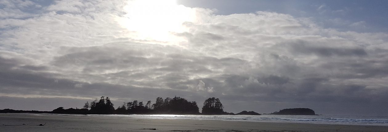
The Northwest Territories’ Mackenzie River is the centre point of the longest river system in Canada, and includes the second largest drainage basin of any North American river after the Mississippi.

At times, it’s large enough to make you feel as if you’re on an ocean.
Happy Friday. 🙂

Gorgeous shots, Lynette. Enjoy your weekend.
LikeLiked by 1 person
Thanks, Jill. You too. And congratulations on your new publication. 🙂
LikeLiked by 1 person
Thank you, Lynette!
LikeLiked by 1 person
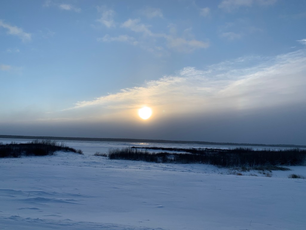
The Mackenzie River doesn’t look too daunting in the winter when covered in a layer of snow. Looks beautiful. Enjoy your weekend.
LikeLiked by 1 person
That’s actually a layer of broken ice covered in snow. Years ago, before there was a bridge, there used to be an ice road across it (it’s the highway to Yellowknife). Now, with all the warming that’s going on, I don’t think it would be at all possible. Yesterday, we had +3C. This is December in the Arctic! It should be -25 right now.
LikeLiked by 1 person
Knowing what lies underneath would make the ice bridge crossing a bit anxious, especially for truckers. Thanks for sharing. Have a great weekend Lynette. Allan
LikeLiked by 1 person
Luckily, there’s a bridge. And given the global warming that’s going on, there’s no way you could rely on an ice road. We had +3 yesterday. This is my fifth winter here and December is usually in the -20 to -35 range (the later into December, the colder it is). When I took that photo a week ago, there was only broken ice covered by snow.
LikeLike
We hiked the river valley on the 2nd (me in shirtsleeves) and the river is still wide open. A lot of broken ice along the shore, but the frazil pans have come and gone twice. +8 yesterday and the same for today with cool weather not returning until Tuesday?
LikeLiked by 1 person
Wow. I have very close friends in Medicine Hat, and we chat fairly frequently. Their weather has been wild. They had -20 one day and +20 two days later (that was back in late Oct, I think.) It has been very sporadically up and down since.
LikeLike
What do you do on that wide expanse of water? Just curious.
LikeLiked by 1 person
There’s LOTS of boating. It’s First Nation river/land and there are many traditional activities, both winter and summer. The day the summer photo was taken, I saw a water skier (I wouldn’t want to try that in winter. 😉 )
LikeLike
Let’s see. That would be skijoring, right? Thanks for the chuckle!
LikeLiked by 1 person
Hahaha. That’s great. 🙂
LikeLike
You’re not kidding it looks like an ocean! Quite beautiful 🙂
LikeLiked by 1 person
It is beautiful, and if you were only looking at the summer photo, you might never know it’s the Arctic.
LikeLiked by 1 person
Wonderful shots, Lynette. Happy weekend to you.
LikeLiked by 1 person
Thank you. 🙂 Happy weekend to you, too.
LikeLiked by 1 person
That’s a BIG river, Lynette. And the winter shot looks sooo cold!
LikeLiked by 1 person
It is an enormous river. The day I took that photo wasn’t too cold, in spite of the snow; it was about +4C. Warm for NWT in late November! We’re expecting much colder temps later this week; about -20C or so.
LikeLike
Keep safe and stay well, and warm, Lynette!
LikeLiked by 1 person